Friday, 10 July 2015

Birdsville to Windorah to Quilpie

Birdsville
It was 186 kms from Bedourie to Birdsville – a lot more gravel road today! Stones flying everywhere & lots of ‘sliding around’ on the gravel. Again people passing really good in getting to the side of the road or off it completely.
Again lots of road kill (kangaroos) & wedge tail eagles & crows at them. Landscape changes from ‘grey lands (floodways & mudflats – ofter green patches beside the road) to red/orange with ridges of sandhills.

We stopped at the ruins of one od Sidney Kidman’s early homesteads, Carcoory. Would have been lovely stone house – flies nearly carried us away!!!!

Also stopped for a photo of the ‘boot tree’. Waddi trees grow nearer to Birdsville – thesemuli-sapling like & VERY hard wood, popular for ‘building & fencing in early days – also the termites didn’t like it!

Birdsville still very busy; very dry & dusty! Flies!!! Sign - Population 150 (+ or – 7,000) – grid of half a dozen streets. You virtually drive into the caravan park from the ‘highway’! 52 powered sites & LOTS of unpowered camping down beside the Diamantina River – lovely outlook. $40 a night for power.

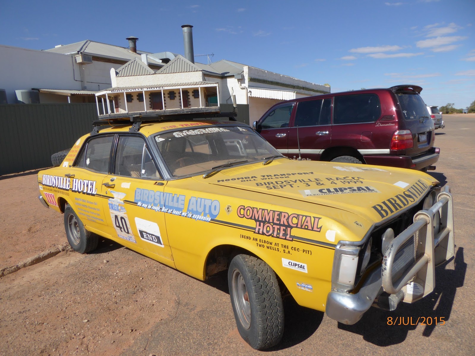
We walked the streets – I bought a fly net at Frontier Services! – good museum display of it & local ‘hospital’/clinic from early days in 1930’s. The Birdsville hotel there & the same façade from 1884 with the airstrip right across the road!

We checked out The Bakery – known for curried camel pies but none left!; bought multigrain bread $6.50. The museum closed now – they are hoping ‘all the contents’ will go to the one in Longreach. Camel rides operate from outside it.

We drove to toen entrance to see the artesian bore that supplies the town – water piped out at 98 degrees centigrade, there are no iron or sulphur minerals in it so once it has cooled down in the channels (steam pouring off it!) it is pumped up to water tower!

Out to the racetrack – out of town, on other side of the river & Burke & Wills Tree (supposed to have carved initials there). People free camped everywhere beside river or just ‘in the bush’! Signs up ‘no free camping in town limits’.

We walked up to the hotel for dinner (5.30 – 6.30) but the line was out the door so we walked back & had tea at van. We walked up for outside showing of last State of Origin game (on BIG old fashioned screen). They had a big pit fire & about 80 watching it  - lots of families. We lasted till half time – we’d worn jackets & parkas but still COLD (3 degrees!) so we came back to listen to the NSW whitewash by Qld– 52 – 6!!!! in the warmth!.


Guy next to us suggested taping flattened cardboard boxes to back window against stones thrown up on gravel road. He said so many cars had arrived in Birdsville with shattered back windows. We did this as well as closing all curtains & taping door vents.  


Wednesday, 8 July 2015

Boulia to Bedourie

Boulia to Bedourie  - Tues 7 July 2015
COLD overnight & 5 degrees again in morning. We were away at 8.15 after our porridge! We got petrol yesterday ($159.9 lt).
We put the stableriser bars on, thinking they would help on the gravel road today. Only a few stretches of gravel (all grey rounded stones not dirt!) – quite deep groves. The bars didn’t last long & we had to stop & take them off – luckily the road surface allowed Warren to swivel them right around & able to be taken off quite easily!

We stopped at the Tropic of Capricorn marker on the ‘natural treeless plain’. I took a photo of Warren – with a little tree right behind him!

360 degrees of dry country; no cattle until close to Bedourie; no animal life except for flocks of finches & pigeons, few hawks. Trees line to creek & river beds. In a few places beside the road saw lots of (on vines) small paddy melons (like).

One of the huge stations along the way was Marion Downs. We could see a ridge (about 33m high) with picnic table, loos etc ‘off the road’. We drove up (3km) another guy come from Birdsville there. INCREDIBLE view! Cold wind blowing, had to put parkers on. A willy wagtail there! LOTS of traffic passing from Birdsville. The guy said they had had a special Anzac Day service there this year with 100 horsemen riding down the highway & up to it (wide curved road up). It was the Vaughan Johnston Memorial Lookout, he was State MP for area who pushed Govt & insisted outback needed sealed roads – we certainly appreciated him!

Overnight at Bedourie – Oasis CP – AN ENSUITE!!! $35. VERY WINDY & FLIES!!!!! After lunch we walked up town – another great Info Centre (DVD of floods when water channels fill & run to Lake Eyre. Mud Hut from 1880’s. artesian spa pool, historic hotel & shop at the Roadhouse. Petrol $1.78.9 lt)


LOTS  traffic coming up from Birdsville – lots staying here – 2 caravan parks.

 So much roadkill on the roads! Wedgetail eagles would wait until the last minute to fly off
 Boulia
 Boulia - great little town
 Brolgas
 Min Min Lights exhibition
 Burke River after 4 years of drought
 Vance Johnson lookout - rest area on top - incredible to see (300m high)  in the distance from the wide FLAT plains!


 100 million year old dinosaur bones & fossils from the inland sea
 Tropic of Capricorn marker
 Bedourie means 'place of the dust storm' depiction
Bedourie camp oven - first made there

Mt Isa to Boulia

Mt Isa to Boulia
Cool morning again (11degrees). We were away at 8.40 after getting petrol ($1.47.7 lt).
300 kms to Boulia – road mostly one car wide strip on bitumen – passing area every so often. Quite a bit of traffic – all very good, either moving to side of strip to pass or getting off it completely. No roadtrains thankfully.
Scenery changed from rocky hilly outcrops nearer Mt Isa to wide barren dry stretches to areas where land covered in semi-circular spiky clumps of grass, to straw coloured plains as far as the eye could see. Only a few cattle – there has been drought conditions for last 4 years. Whole area is Channel Country where floodways (signs all the way along the road) & floods caused when rain comes. Waters run into Lake Eyre.

Small settlement of Dajarra was about half way. It used to be the biggest railway junction for cattle transport from Northern Territory & Queensland. Now it’s mainly an aboriginal settlement – newish very nice houses everywhere!

Sitting with a couple on their way north we learned that there was The Outback  BASH on near Birdville!!! At Big Red Sandhills (35kms east of Birdsville, on edge of Simpson desert) & there 4,000 people staying at Birdsville – place completely booked out until after Monday night – the last night of the Bash!!!!! People would be leaving Birdsville from Tuesday – probably!!!
Wedge tailed eagles feeding on road kill kangaroos along the way.

Boulia Caravan Park really nice. $27 a night – lots of grassy, shady sites  & beside near empty Burke River (explorer Burke named it after himself when they camped here in 1860/1. About 30 lots of campers here. Their BIG weekend (Camel races) in 2 weeks time when they cram 150 lots of campers in!
We decided to stay 2 nights (Sun & Mon) then go to Bedouie on Tues – hopefully not a lot of traffic coming other way – 190 kms – patches of gravel road.
Sunday night we walked up to the pub for dinner (counter meals –crumbed chicken $18, c. steak $15 or c. sausages $13 & chips!). A kangaroo jumped across in front of us on way back!
COLD overnight & 5 degrees in morning! Thankful for our little heater!

Monday - lovely day visiting The Stone House Museum & Fossil Display ( Whole area part of inland sea 100 million years ago - fossils of giant dolphin like dinosaurs, turtles  other fish - incredible). Also Min Min Lights presentation at the Info Centre – both excellent! The latter where you walk around six 3D sets with holograms /graphs)?) figures telling people’s stories of seeing min min lights.
No phone reception for us (was for Telstra) or internet connection – even at library!

We are watching Homeland 2nd series, Clare lent us – good!

Cloncurry to Mt Isa

Cloncurry to Mt Isa
It was 11 degrees in the morning – so different to Normanton!
It was only 118kms from Cloncurry to Mt Isa – a very scenic trip. ''Up hills & down dales’ double lanes of bitumen all the way – Barkly Highway. There were great outcrops of incredible coloured strata (vertical & horizontal!) rocks a lot of the way as well as the red/brown ranges.
Not much live wildlife – lots of road kill again. We passed the site of Mary Kathleen where the uranium mine was before the 1970’s. I remember we (Sandy Burns, Denise Pollock & Viv Blandford – from Lake Cargelligo Central School) did a tour to central Australia in 1970.

We stayed at the Top Tourist Caravan Park in Mt Isa – sign said there were no powered sites but we had quite a lot around us. A dirt bowl, on the banks of the creek/river – lots of water. Lake Moondarra is just out of town.
I have been trying to have my hair cut for last 10 days – either no hairdresser in town or one (young, English girl) in Cloncurry could not fit me in until ‘next week’ – not a sign of a person in sight! I asked about an appointment in one shop & was told it was $68 for a cut & blow-wave!!!!!

We went up to the lookout & Information Centre – very informative & have everything from Fossil & Gem ‘Museum/Display” to café to everything else!
We did a tour of the Underground Hospital. It had been built during WW2 in case the Japanese invaded. It was originally built as a air raid shelter but decided a hospital would be imperative.
There was NO PAPERWORK about it anywhere. It was incredibly well thought out, planned & excavated & stocked with EVERYTHING a hospital would need. At the ned of the war the doors were closed & no one knew it was there until the land started to subside in 1970’s & surveyors were sent to have a look. They decided it was too dangerous & sealed it up again until discovered in 1990’s. A group from local community took on restoring it – replaced lots of supports etc but they left everything as it had been in 1940’s. Wonderful!


There was a VERY full free camp by the Leichhardt River near Lake Mary Kathleen.
 We could see the 65 foot, red & white striped chimney of the Mt Isa (silver, lead, zinc & copper) from quite a way out. The town is virtually built alongside it. It’s been there since the late 1920’s.


Friday, 3 July 2015

Normanton to Cloncurry

Normanton to Cloncurry
We left at 8.20 - 376 kms today half way point was Burke & Wills Roadhouse. Just about everyone stops there – some coming back from Lawn Hill National Park & Gregory Downs. Petrol was $172.9 – we got 20 litres. We had morning tea there.

So interesting to see the distinct changes in the vegetation – from savannah (high yellowy grass, small trees, small termite mounds) to dry floodplains of wide green grass beside the road; great rocky outcrops of dark brown rocks or limestone coloured marble affects often along the way.

The road is a Development Road so quite narrow parts where passing vehicles have to get mostly off the road & dirt & dust fly! - & other stretches of wide 2 full lanes.
Lots of ‘3 BIG BINS/trailers’ road trains from the mines in Cloncurry.

More dead kangaroos with crows & hawks on them We saw 3 BIG black & white (bird book says (Papuan Harriers) who try to carry the whole animal away as a car comes up to it. A BIG browny - orange goanna walked across in front of us!

Coming up to Cloncurry like coming up to Broken Hill – lots of high rocky outcrops.
We are staying at the Discovery caravan park – half of it is mine workers accommodation (long cabin type rooms; a portable gym, ‘mess hall’, laundries of front loader machines & driers we can use for free as well.

Lots of miners & other workers back late afternoon – walked into town later in evening. We heard lots of (ore?) train whistles at night.

26 during the day – Warren went in the pool but VERY cold!
A doona night – 10 degrees – lovely!  (Lowest temp ever in Canberra minus 7!!)

After a hot breakfast & I washed – we went sight-seeing. There was a Gem & Minerals Buyers Festival on at Info Centre – quite interesting – about 15/20 guys showing & selling. A few other market stalls.

We went out to the lookout & Chinese Creek dam area for morning tea – very pretty. Pelicans, ibises, hawks.
Also went out to airport (saw Virgin plane arrive) to see the original QANTAS hanger where their first commercial flight was from in Nov 1922. Also big John Flynn & Flying Doctor Service display centre in town.

At night we went to the Miner’s Mess for dinner ($25)


Thursday, 2 July 2015

Gulfland train trip

Gulflander train
We left Normanton Station at 8.30 & arrived at Croydon 5 hours later – 148kms. Top speed 37kms per hour but usually 25kms. Diesel engine – PULLING 46 tonnes – used 25 litres of fuel!!! Normanton built on ‘higher ground’ due to flooding in wet season. In 2nd worst flood in 2009 town was cut off for 13 weeks!
It’s the only rail of it’s kind. Built 1888-91; using special C shaped steel sleepers of which 95% still there. It's a bus on rails!

We dropped off the mail at Haydon’s Station (200 sq miles) of cattle. Morning tea at Black Bull Siding – where rail crosses from one side of road to the other. We got Gulflander enamel mugs as souvenirs with our tea/coff & muffin!.
Lots of disused gold mines, creeks, lagoons, (alive!) kangaroos, brolgas, pelicans.

We had great hamburger at the café in Croydon. Bike riders (100) from Cairns to Karumba (800kms) Charity Ride arrived from 2.30 on. They stay in Croydon overnight then ride to Normanton & Karumba tomorrow. They are raising money for educational 'extras' for outback kids eg georgetown school went to Sydney, Canberra & the Snowy!
We got the coach back to Normanton.


Croydon to Normanton - Karumba

It was 148 kms of mostly straight fairly good road from Croydon to Normanton, 35kms (as crow flies) from Gulf of Carpentaria. Savannah landscape - browning off but quite a few small dams & waterholes & groups of Brahman cattle, drought conditions have drastically reduced numbers & their ‘condition’. Lots of small (1m) yellow flowered trees (fellow with pet lorikeet on his shoulder, at Croydon pub, told us they were a cotton (something) tree but not sure about it!) all seem to have been planted in rows but occur naturally; also small green-grey finer leafed trees.
The railway for Gulflander train runs beside the road. It is a bus on the rails that supplied & carried gold back to ‘port’ on the Norman River here from mine at Croydon  in 1880’s. Over 23,000kgs!
We stopped briefly at Black Bull Siding where the Gulflander crosses from one side of road to the other - & where we’ll  have morning tea on our Wednesday trip.
Quite a few cattle stations off the road; also Critters Camp & small lagoon where there were lots of birds (brolgas etc)
Normanton (pop 15000, mainly aborigines – HOT, 30 degrees (cools to uncomfortable 27 overnight! – love our efficient air-con!), 3 hotels, small supermarket, great butcher shop, couple of galleries, HUGE replica of largest crocodile captured (28’) in park, 2 caravan parks – pool & spa & we have great site in mostly shade!!!! Pool water COLD but we both went in!
Off to Karumba (pop 600) on the gulf today – BIG fishing, prawning centre. K divided into 2 – The Point at mouth of Norman River & town 8kms away. Funny how you imagine what somewhere will be like, then it so different – K is called ‘the most outback town on the sea’.  It did have a bakery & bigger supermarket than Normanton! Still a small country town!

Crocodile warnings all along waterline; Barramundi, chips & salad for lunch at the tavern & king prawns home for tea – YUM!